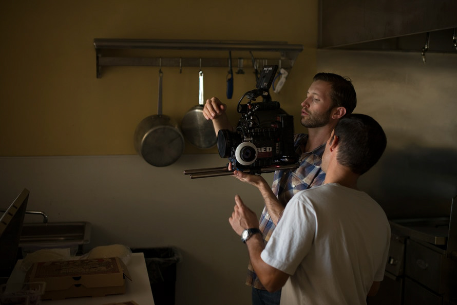
It seems that during the recession of 2007-2009, and now with whatever you call the economical funk that we are in, the one industry that didn’t seemed phased was the film industry. Particularly there were some major box office hits like The Dark Knight, Indiana Jones and the Kingdom of the Crystal Skull, The Curious Case of Benjamin Button, Iron Man, Quantum of Solace, and The Chronicles of Narnia, all played a pivotal role in 2008, to help gross nearly $10 billion for Hollywood (Aune, 2009). The point I am trying to make is that regardless of a recession, Hollywood seems to come out on top. How does this news affect me? First as an amateur filmmaker, this is good news for me, because here is a strong market, which always has room for more, and is constantly growing. As a geographer, it means I can market a product to an industry that has the money to spend on it; either way it is a win-win.
Let’s face it, if you are a visualist, which many geographers (and filmmakers for that matter) are, then you want to be surrounded by things that are visually designed well. I recently took a screenwriting class here at UNO, and an issue I had with it, was that it was on paper. In black writing on white paper, like the way this paper you are reading is. What if there was an app, which the filmmaker could use while on or near, or preparing a location? We have all heard of location scouts (and there is already an app for that), but what if we could take the script and literally map it out? Well we can, and that is exactly what I did.
Like I mentioned before, I was in a screenwriting class this past semester, and the product of that class was my very own screenplay. Originally it was meant to be a full feature film, but in the end, I decided I would rather make a brilliant short film, than a poor feature film. I would consider the film to be a geography film about Omaha, yet there is a fictional plot that weaves itself throughout the film and subsequently throughout the city. The actual story is about a twenty-something recently heartbroken musician who can’t wait to get out of town (Omaha), but is forced to take his boss’s niece around town to show her the “scene”; in the end as he is falling in love with the girl, he is falling back in love with the city. The film is called I Love Hate Omaha [later renamed Omaha], and I plan on shooting it in the late spring early summer of 2013.
In this project I used the inspiration of mine and Kelly Koepsell’s last project on James Bond, and mapping the locations in the film, so a potential film tourist, could use that information to ‘relive’ the scene in the film. In that project we used ESRI’s Attribute Inspector as a base tool to build our app. When approaching this project, I liked the functionality of Attribute Inspector, and chose to use it to help dissect my screenplay and adjusted it to fit the map.
The functionality of my web app is that it gives you a set of point on the map (represented by hearts, to go along with the story).

Ideally you click on the map to see where you are in the script, or where that location is in the script. So if you plan on shooting the film within a certain amount of time, then it is easier to decide when you are going to film certain locations, at certain times. Take my film for example, the actual film follows a distinct path throughout the landscape, which resembles some sort of a circle, but If I had two weeks to shoot the film, I may shoot some locations out of sequence, because they happen to be near each other. Below you can see what happens when you click on a heart.
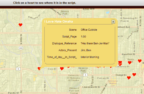
This location happens to be the first scene in the film, you can tell by seeing the Script Page, also the information given is the Scene Title, Dialogue Reference (which shows, the first piece of dialogue in the scene), the actors present (with whoever speaks first, listed first), and the time of day in the script. The time of day in the script matters, because if you do plan on shooting multiple locations in a given amount of time, you want to make sure that the natural (and unnatural) light is correct.
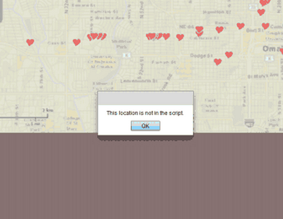
Of course when you click outside of one of the hearts, you get an error message, like we see below.
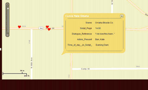
There were some challenges that I faced, when building this application, such as when you pinpointed the location, and clicked on the heart, you would have to click on the exact center of the symbol, otherwise it would not work, and you would get the error message. What I had to do was create a second layer, and make a buffer, thus creating a polygon, instead of the point, allowing the click to be easily accepted by the application. Picking the right buffer size was an issue, which I still haven’t resolved, because the suggested buffer is 250 feet, which I used, but it doesn’t work when more than one location is within 250 of each other. If you look in the example on the top of the next page, you can see that this particular click, which theoretically should be along Maple St. where the other location is, which I assume is 250 feet away from its needed location. This happened, I am guessing because one of the other locations is within the 250 feet of this location. This could be an issue with a director that is unfamiliar with the area that she/he is filming in, so the location truly needs to be exact.
That in a nutshell, is my entire app, aesthetically it could use some help, and in the future it is really only applicable for a filmmaker if it can be used on a mobile device, so it would need to be integrated into a mobile platform. This goal and others will need to be implemented in the future, in order to make this a viable product, and hopefully get a piece of that $10 billion a year pie. This web application is no longer active.
Works Cited
Aune, Sean P. “Movie Industry Has A Record Year in 2008, Still Not Happy.” Movie Business. N.p., Jan. 2009. Web.
Chadwick, Jacob. “I Love Hate Omaha ScriptMap.” I Love Hate Omaha ScriptMap. N.p., n.d. Web. 12 Dec. 2012. <http://gis2.unomaha.edu/JCscript/ScriptMap.html>.
I Love Hate Omaha. Dir. Jacob Chadwick. 2012. Transcript.