The Central Hazardous Materials Fund (CHF) is a nearly $10 million fund that promotes and supports environmental cleanup on federal lands across the U.S. As a member of the CHF team, I was tasked to redesign the static html-based map.
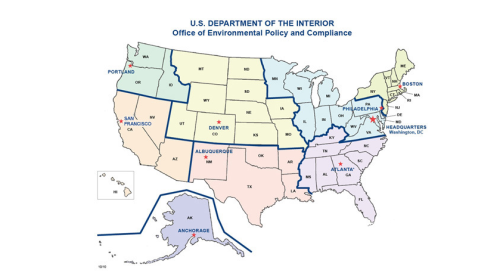
The original html-based map, where you click on a region that was hyperlinked to the page below (a series of tables based on the region, which you had to scroll through to find the site).
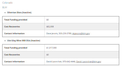
The tables need to be updated quarterly, in order to keep up with the constant total finding dollars.
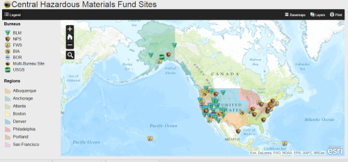
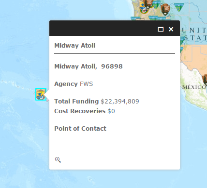
Created with Excel and ArcGIS Online, the new CHF Map featured site-specific data, zoom capabilities (for security reasons, the site disappears, if you zoom in past a city view), regions outlined, bureau logos, and up to date information. The 2.0 version will include a short write-up (with current status) about the site, a photograph, and links to more information.